
Hiking/Biking
Hiking on the original logging trails where wilderness surrounds you, provides a tempered trek into the vast swamp. The late Moses White, a successful logger, timbered in the Dismal Swamp. 18th century timbering of Juniper and White Cedar supplied shingles for the north, transported by lighters (a flat-bottom boat) on the Canal. Ironically, yesterday’s history provides for today’s opportunities.
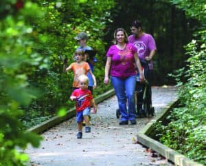
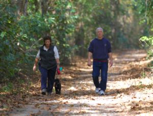
Plan a day visiting the Dismal Swamp. Enjoy a leisurely hike or bike along the Dismal Swamp Canal Trail, a 3 mile paved trail managed by Camden County Parks & Recreation . Bring your camera or binoculars to catch your favorite feathered friend or maybe a soft, fuzzy mammal. We are proud of the fact that we are recognized as a part of the NC Birding Trail and East Coast Greenway. Bring a picnic lunch and spread out your fare on our picnic tables, under the pines. Public restrooms are plentiful.
The Dismal Swamp State Park offers miles of former logging roads for hiking and mountain biking. Bring your bike or rent one from the park. Men’s, women’s and children’s bikes are available, as well as helmets.
- Cross Canal/Bull Boulevard is a quiet, grassy road deep in the swamp, where a few cypress and cedar trees grow. You are likely to find bear sign, wood ducks and otters. (2.25 miles)
- Canal Road is a great place to observe animal crossings. A replica liquor still is located 0.25 miles up the road, near the first Supple-jack Trail junction. An example of a lighter boat can be found near Cross Canal. (2.20 miles)
- Corapeake Ditch is located just south of the NC/VA border. At the intersection of Corapeake and Forest Line, you can observe the effects of the 2011 wildfire, which burned for 111 days. (4.80 miles)
- Forest Line Road is a gravel trail deep in the Swamp where Atlantic white cedar trees dot the shoulders. Black bear and otter are frequently seen here along with herons, ducks and the occasional bald eagle. (2.30 miles)
- Kim Saunders Road runs west, nearly straight across the park, from its intersection with Canal Road. Black bear, turkey, bobcat, and butterflies can be seen here. Birders will enjoy this trail for the many warblers frequenting the woods. (5.40 miles)
- Laurel Trail runs north from Kim Saunders to Corapeake. From there you can continue west further into the park or turn east and visit the water control structures near the park’s eastern boundary. Black bear and bobcat frequent this area. (1.00 miles)
- S. Martha Washington Trail begins a few hundred feet beyond the end of Canal Road. This trail is the park’s newest, and connects Kim Saunders and Corapeake. (1.20 miles)
- Supple-jack Trail is a hiking-only trail that winds visitors through dense vegetation and connects to Canal Road. Deer, birds, frogs, toads and snakes are seen here. (0.50 miles)
- The Swamp Boardwalk is located behind the Dismal Swamp State Park’s Visitor Center. You can get a feel for the Swamp without getting your feet wet! Frogs, turtles, snakes birds and the occasional bear or bobcat can be seen here. Learn more about plants and wildlife from the interpretive panels found along the loop. (0.50 miles)
Dismal Swamp Canal Trail
This three mile paved trail begins at the southern end of the Dismal Swamp Canal Welcome Center/Dismal Swamp State Park off US Hwy 17 and meanders through a wooded area between the historic waterway and the historic highway, ending at NC Hwy 343. A 5 foot wide extension provides access for the trail to the Village of South Mills. This trail is beautifully maintained by Camden County Parks & Recreation.